We start looking towards Wicker hill from the town bridge.
And here's the same scene in 1400. The little stone lockup by the town bridge isn't built yet, The old bridge was much narrower so the angle of the road on the far right is different. Click the 2nd thumbnail to see the view today and the 3rd thumbnail to see where we are on the old map.
When looking at the map don't forget the street map was copied to a very small scale as part of a map of all of Wiltshire by people who had never been to Trowbridge, so is in places a little wonky, like the image we see looking into a spoon.
When looking at the map don't forget the street map was copied to a very small scale as part of a map of all of Wiltshire by people who had never been to Trowbridge, so is in places a little wonky, like the image we see looking into a spoon.
At the junction of Hill street (to the left) and Wicker hill (to the right) When the large stone building that occupies most of this scene was built by the pioneer benefit society, they changed the building line a little, the original building plots can be seen in this pic from 1910, and I've used those in the model.
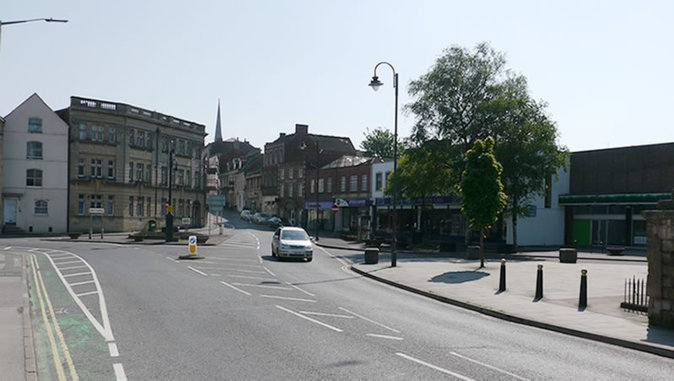
.Turning right we look up Wicker hill. The map is seriously wonky in how it portrays the relationship between the 2 sides of Wicker hill, so a map with an arrow showing you where you are isn't useful. From this shot you can see how Wicker hill got it's name. The wicker fence was there to stop people ( including late night drunks :) from falling down and drowning in a remaining short length of 4 metre deep ditch that once surrounded the whole castle.
If you click on the 2nd thumbnail you'll see the view as it is today. On the rest of the tour the 2nd thumbnail will show the scene as it is today.
If you click on the 2nd thumbnail you'll see the view as it is today. On the rest of the tour the 2nd thumbnail will show the scene as it is today.
Moving up Whicker hill.
Moving further up Wicker hill. Notice the opening in the whicker fence to the right.
Here's that opening again, and if you click on the 2nd small thumbnail, you'll see how that opening and probable old right of way looks today.
Moving even further up Wicker hill, up on the right we see a lovely old double gabled Oak framed building that survived until the 1850s.
But before we see that, here's a view looking back down Wicker hill with the old town bridge in the distance. 2nd thumbnail shows the view in 2014.
Here's the fine double gabled merchant house from which it's believed Bowyers started making and selling pies in 1816. 2nd thumbnail shows the scene in 2014 and the 3rd thumbnail is a drawing of the building from 1851.
From the doorway of the Merchant house we see to the right the small open market hall and to the left through the partially opened gates, the manor. If you click on the next thumbnail that show's how the scene looks today, you can see what's left of the Manor entrance. A little gap, with a white gate as it was once a pathway, now filed in with a small extension.
Here in the centre of the shot we see the small Market hall. They were usually part of the town shambles, which was an area where animals were killed and butchered outside in the street. The meat was then hung under the market hall or under the overhangs of the butchers shops. In Bridport the shambles had a wall. Killing involved laying the animal on it's side, binding it's legs and slitting it's throat. If you didn't want to see that, you stood back from the wall, but if you wanted to exercise your legal right to see your meat slaughtered, you looked over it. The wall was also used for chopping meat.
If you click on the 4th thumbnail you can see he whole shambles/slaughtering area. I've seen a couple of Youtube videos of bulls being street slaughtered this way in India, and the cobbled area shown next to the market hall is about the right size for 7 men to hold and kill a large bull.
If you click on the 4th thumbnail you can see he whole shambles/slaughtering area. I've seen a couple of Youtube videos of bulls being street slaughtered this way in India, and the cobbled area shown next to the market hall is about the right size for 7 men to hold and kill a large bull.
Moving further up Wicker hill we see a fairly large open area that was pretty likely a market, the house on the right stands just in front of the site of the present day Lloyds bank. As you can see the road Lloyd's is sited on doesn't exist. The right turn here didn't happen until the west of Trowbridge was developed. Also, on the other side of the wall on the right is a very deep ditch and earthen ramparts of the old castle.
Further up still we see the turning on the left is Manvers street, and in front of us is a completely lost road. We'll go up there in the next part of the tour.
But 1st, a quick look down Wicker hill hill from here.
But 1st, a quick look down Wicker hill hill from here.
Looking down Wicker hill from Lloyds bank.
